License information
-
License
Attribution-NoDerivs (CC BY-ND)

")
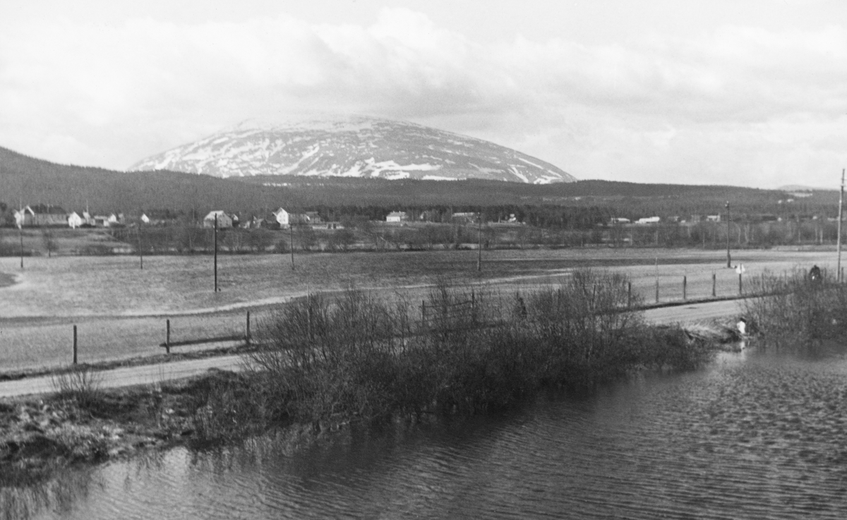
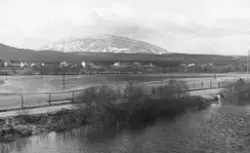
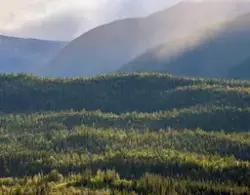
Den 23. mai 1942, på den tida dette fotografiet ble tatt, publiserte avisa Østlendingen denne artikkelen med store vyer, preget av datidas politiske strømninger, for kanalisering a ...
Den 23. mai 1942, på den tida dette fotografiet ble tatt, publiserte avisa Østlendingen denne artikkelen med store vyer, preget av datidas politiske strømninger, for kanalisering av Glåma eller Glomma:
«Vi tar tiden til hjelp i Glåmas land
Parallelt med den mektige vannvei fører våre ferdselsårer mellom syd og nord og klynger seg til det storladne vassdrag med sine unyttede beringelser som landets store alfarvei.
Når vi sier at den 60 mil lange Glåma har sitt utspring fra Mustjernet på Tydalsfjellene, vil hver skolegutt i dette land protestere og si at det er Aursundsjøen som er Glåmas utspring. Når vi videre sier at vassdraget har formet over tre mil elveløp før Aursunden går inn i dets register av de om lag hundre sjøer med Mjøsa som en god nummer en, setter klassen sikkert opp store øyne. Den almuesvisdom som skolebøkene våre har gått god for er altså i høy grad summarisk og overfladisk. Men vi mener at det koster like meget å lære riktig som galt, akkurat som det synes oss forferdelig trist og forkjæørt at vi skal gå over bekken etter vann i den grad at våre samferdselsforhold syner oss på vår vei etter Glåmas vannvei. Hvorfor har vi nettopp i vårt land hatt en tendens til å leve og virke så stykkevis og delt på mange områder, når våre naboer har hatt omdømme nok til å gripe til den naturlige og nærliggende løsning? Se nå på Klara (Trysilelv) – ikke før er den over grensen før den tjener det svenske trafikkvesen med sin uforstyrrelige innsats. En elv som Glåma på den andre siden av Kjølen vilde der nok blitt en imponerende seilled, planmessig nyttet i landets trafikk.
Våre bankierer har imidlertid fra hundrer av år tilbake fortalt oss at vi i vår fattigdom ikke har råd til å foreta noe større annet enn det som har bekommet visse pengeinteresser vel, derudi at de måtte få en personlig vinning gjennom en smule innsats. Hvem vet således at vår hovedbane, da den blev bygget fra Kristiania til Eidsvold, var resultatet av et vellykket angrep på den store kanalplan i Glåma som dermed blev veltet – og siden har vi kjørt bane med engelske kull og vært fine folk. Men mer om dette siden.
Glommendalen og Lågendalen – eller Østerdalen og Gudbrandsdalen er utpregede hoveddalfører som begynner trangt og ender åpent, veldig skoglandskap der elvebandet løper bredt og rolig med få fossefall. I hovedløpet til Glåma er det således ingen betydelige fosser mellom Kuråsfossen nedenfor Aursunden og Braskereidfoss i Solør. Det samme er tilfelle i Lågen, hvor det fosser noe ved Harpefoss og Hunnerfoss, men ellers er fallet jevnt. Veldige tømmermasser går årlig i hovedelva fra disse trakter.
I Glåmas nedre del var det omkring århundreskiftet opptil 17 meters høydeforskjell på flomvann og lavvann. Dette førte til at det blev forholdsvis store muligheter for større vannkraftanlegg som nå er kommet etter hvert.
Glåmas samlede fall på sine mange mil er om lag 700 meter konsentrert i til dels betydelige og naturskjønne fossefall – for å begynne nedenfra med den største og mest imponerende nevner vi den 21 meter høye Sarpsfossen ved Sarpsborg med Borregaards store fabrikkanlegg. På en strekning av et par mil nedenfor Øyeren ligger så etter hverandre Vamma, Vrangfoss, Kykkelsrud, Solbergfoss og Mørkfoss med sine store kraftanlegg og imponerende demninger. Ovenfor Øyeren finner vi først den kjente Fetsund tømmerlense, hvor en mektig mønstring av vassdragets tømmervirke gir oss et lite bilde av hva verdi en vannvei som Glåma er for skoglandet Norge. Så passerer vi Bingen lenser og Bingsfoss, Sundfoss og Rånåsfossen med sin store kraftstasjon. Før vi kommer til Eidsvoll finner vi i Vorma Svanfossen. I samkjøring med andre kraftkilder som f. eks. Nore kraftverk får vi over Østlandet og spesielt Stor-Oslo med tilliggende oppland alt vårt kraftbehov fra Glåmaverkene som kjent. Etter hvert vil Glåmas vannmasser fra et over 40 000 kv. km. stort nedslagsfelt bli mer og mer regulert med heblikk på driftsvann, idet utbygginger og nye reguleringer er i gang i høyfjellet, hvor Tyin, Bygdin og Vinstervatnene finnes. Likeledes er det kunstige reguleringer i Aursunden, Storsjøen og Osensjøen, samt utvidet regulering i Mjøsa. Reguleringen som trafikkledd og som ledd i de kulturarbeider der krever et høvisk elvedrag med respekt for jord og skog og eiendom, er ennå i sin vorden. Vi erindrer den store skade som Lillestrøm-flomskadene har vært i alle år og vel atter kan bli for alt det vi vet, og vi tenker på de veldige muligheter som fra gammelt av er kastet inn i form av tanker, nå: det gjelder å dempe vassdragets vannmasser ved f. eks. å ta en del av det gjennom Rendalen etter Jutulhoggets anvisning. Eller å føre driftsvannet fra Øyeren til Oslofjorden (kanaldirektør Sætrens plan fra 1880-årene). Slike gamle tanker er jo i dag ikke lenger aktuelle, men de viser at vi har hatt åpne sinn med blikk utover dagen og særinteressene. Derfor er de da også alle oftest blitt på papiret.
En eiendommelighet må nevnes ved vårt lands største vassdrag, en eiendommelighet, som lik en forferdelig trussel til vårt lands gamle styre og stell tross alt er blitt med trusselen hittil: Glåma er ved Kongsvinger og Vrangselv-vassdraget bare adskilt fra fritt leide til Sverige ved en naturlig demning av jordmasser som bare er ca. 4 meter høyere enn Glåmas lavvannstand. Og i flomtider går det vann fra Glåma til Sverige her!
Et gjennombrudd med det resultat at Glåmas vassdrag drog over til naboen blev intet mindre enn en landskatastrofe. Foruten all skaden vilde jo kraftanleggene nedenfor Øyeren bli renons. Altså får vi håpe at Glåma på tross av den stedmoderlige behandling den er blitt til del hittil hos oss, fremdeles lever i håpet og blir i landet. Det kan jo heretter være visse utsikter til å komme med i samfundets virke for folket – og for skogen i det veldige Østerdal for den.
Også inn i Storsjøen i Odalen går Glåmas flomvann. Skulde det kanskje her være rom for en regulering med henblikk på flomdemping i Glåma?
Mens vi nevner dette med skogen passer det bra å skyte litt inn om forholdene i vår brenselssituasjon idag. Tenk om vi hadde hatt den snare og billige – og villige autostrada for de mektige Østerdalske skogvidders avvirkning som Glåmas kanalled naturligen har vært, ferdig og i full drift. Da hadde vi ikke trengt å bekymre oss med hvor vi skulde ta de stakkars 150 tusen vedfavner til Stor-Oslo for vinteren. Da hadde vi levd i en rommelig tid – like rommelig som Glåmas kanalled. Men i stedet har vi vei og bane langs etter vassdraget – i kryss og på tvers med veldige buespenn i de enorme bruer, som jo også koster en slomp. For skogvirke som ved er imidlertid ikke disse trafiokkårer effektive, andre oppgaver må gå foran – og så står vi der.
Den 10 mil lange, fullt ferdige seilled som Mjøsa er, betyr bare det alene en triumf for saken om kanalled der veier tungt.
En lengsel stiger opp i vårt sinn – en lengsel som minner om samfundsborgere der til spott og spe for seg selv i sin tid ropte høyt til våre demokratiske folke- og samfundsstøtter om løsning av de livsviktige opgaver først! Og vi ser det slik idag, at hadde Glomma ført skuter på ryggen, da hadde den betydd alt for oss. Men nå betyr den altså intet på det felt til så lenge.
Så skal vi nevne litt om den doktorering som i de senere år har vært nødvendig for å bøte på flomskadetendensen i Glåma. Vi vet at det i 1916, 1925 og senere er gått store skadeflommer i vassdraget. Og i flere bivassdrag, som Folla, Rena, Imsa og Åsta (skadevatn frå Åsta kan føres ned i Mesna og hjelpe på kraftproduksjonen der) og ikke å forglemme Finna i Lågen (Vågå), har det jo til dels vært katastrofale ødeleggelser av flom. Planer og arbeider mot alt dette foreligger og er avgjort. Det er svære summer det dreier sig om.
For å tilgodese fløtningsforholdene i hovedelv og bielver er blandt annet foreslått store tømmertunneler og andre kostbare innretninger. Hvis der på et tidlig tidspunkt var gått til en fullstendig kanalisering og regulering av vannforholdene, kan hende ikke det var blitt så svært meget dyrere enn sammenlagt de summer som det nå er gått fløyten. Og så er vi som sagt kanalen fattigere. Eller med andre ord: vi er der vi var.
Til slutt kan det ha sin store interesse å nevne opp det register av tiltak som vårt lands største vassdrag gjennom årene har vært tilgodesett med når det gjelder prosjekter som ikke er kommet til utførelse. Det vil sikkert unnskyldes at det er nødvendig å sammenlikne litt i stoffets gang med bl. a. vårt naboland, hvor det som kjent er bygget ut planmessig kanalsamferdsel helt fra 1800-tallet av.
Første gang spørsmålet om å gjøre Glåmavassdraget til fartssted for skuter og tilknyttet fjorden ved Oslo var oppe, var da generalintendant Peder Anker for egen regning lot en svensk ingeniør (Bagge) utarbeide planer og forbindelsen Kristiania-Strømmen og videre t,il Nitsund-Mjøsa.
Krigen i 1807 kom imidlertid, og etter at planen også var utvidet til å omfatte Glåma til Vinger – hvorfra kunde roes til Elverum – blev saken skrinlagt. I 1811 kom planer om å sette hovedstaden i forbindelse med Øyeren, saken var i 1814 framme på Riksforsamlingen på Eidsvoll. I 1815 blev innbudt til subskripsjon på et kjerratanlegg med farbargjørelse av elva fra Øyeren til Mjøsa. I 1820 undersøktes i detalj farbargjørelsen av Glåma og Vorma. I 1824 blev av regjeringen foranlediget undersøkt kanal i Glåma og Vorma til Fredrikstad. I 1826 undersøktes stykket mellom Øyeren og Mjøsa igjen. I 1844 stilte havnedirektør Johnsen forslag om farbargjørelse av strekningen Mjøsa-Rånåsfoss. I 1848 framkom et forslag fra opplandsbønder om å kanalisere Lågen og Rauma, samt vannveisforbindelse Mjøsa-Øyeren.
Kanalplaner blev likeledes fremlagt i 1849 av Engebrigt Soot, kanalinspektør i Fredrikshald, i 1851 av Erichson og Waligorsko, i 1857 av det offentlige igjen, som i 1858 foreslo en generalundersøkelse av Glåma fra Kongsvinger til Tolga.
I mellomtiden hadde en kjent forretningsmann i hovedstaden, Frølich – han fryktet øyensynlig at kanalprosjektets gjennomførelse vilde gjøre Fredrikstad for mektig i forhold til hovedstaden – innledet forhandlinger med bondebefolkningen på Oplandene om en jernbane fra Kristiania til Eidsvold, og reiste i den anledning engelsk kapital. Etter «Frølichs samtid» fant jernbanearbeidets høytidelige begynnelse sted 8. august 1851. Billede av handlingen blev gjengitt i London News. Derved var all kanalled blåst bort, da man trodde at en jernbane (drevet med engelske kull) vilde gjøre den slags «heimegreier» overflødige. Altså må vi også når det gjelder våre manglende kanalleder søke til våre venner i England, som har assistert oss på beste forretningsmessige vis ved å la våre egne verdier ligge til fordel for «John Bull». Imidlertid viste det seg at samtidig var andre land, som Tyskland og Sverige m. fl., fullt klar over verdien av å nytte ut sine vannveier, og tiden framover til i dag har vist hvad vi har tapt på å høre «gode råd» og spise kirsebær med de store.
Samspillet mellom kanalleden og jernbane eller vei og autostrada er såvel sommer som tildels også vinter av stor betydning for hver enkelt av disse kommunikasjonslinjer, der gjensidig støtter hverandre i stedet for som hevdet konkurrerer hverandre ned.
Sentral-Europas vannveissystem forbinder nå alle omliggende hav, og i takt hermed har de enkelte lands arbeid med sine kanalveier foregått. I Sverige er stadig nye kanaler, bl. a. Sveakanal, bygget. I vårt land, hvor vi ikke har forstyrret idyllen fra salig Frølichs dager med noe annet enn planer på papiret, blir det vel også nå en vending i tingene. Vi fester oss ved at en av våre seniorer på dette store Glåmakanal-projekts område, Tollef Kilde fra Østerdalen, nettopp har fremmet et nytt forslag til landets styrende menn. Fra forrige gang han fremmet planen – i 1925 og til nå – er jo snart et snes år, men kanaltanken består. Og i dag tror vi nok, skal vi være ærlig mot oss selv, at det eneste som duger er å bruke vårt eget pund til felles beste.
Bare på det vis bygger vi norske muligheter for norsk befolkning og gjør oss verdige til å møte fram for den nye tid og det nye Europa som en nasjon der nytter sine talenter og ikke lenger graver dem ned.
Vi stiger i land med følelsen av at den samlende hånd i landets stortrafikk ligger i et grunnlag bygget på plan – det være seg en autostrada for samtrafikk med det øvrige fastland eller innenskjærs båtled – eller seilled i landets førende vassdrag.»
Your message will be sent to Anno Norsk skogmuseum.
If you want to keep your stuff, you need to create a user or login.


Add a comment or suggest edits
To publish a public comment on the object, select «Leave a comment». To send an inquiry directly to the museum, select «Send an inquiry».