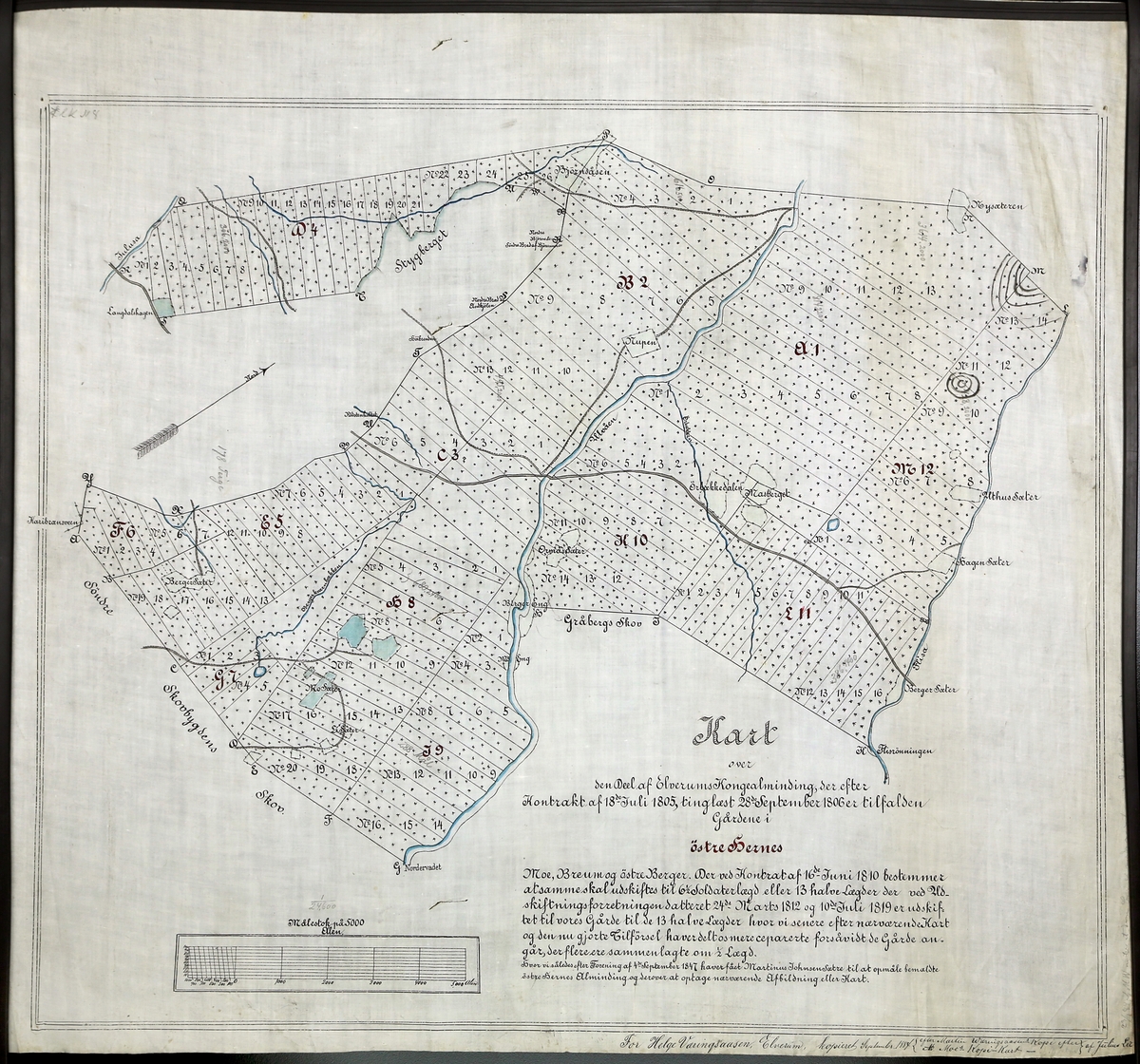
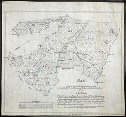
about Kart over skogteigene i Ulvådalen, østre Elverum. Dekker området fra Kjærringhølen (litt nord for Renoset) nordover til Styggberget og Nysætra. Kopi datert 1884 av kart oppmålt i 1847.
Hedmarks-kart i samlingen etter Helge Væringsaasen
I kartsamlingen etter Helge Væringsaasen (1836-1917) finner vi rundt 600 kart fra hele verden. Omtrent 100 er lokale kart fra Elverum og omegn. Her er både utskiftingskart og topografiske kart. De fleste er håndtegnet og kopiert spesielt for Væringsaasen.
Kart over skogteigene i Ulvådalen, østre Elverum. Dekker området fra Kjærringhølen (litt nord for Renoset) nordover til Styggberget og Nysætra. Kopi datert 1884 av kart oppmålt i 1847.
Geir-Harald Strand,
February 16, 2023
Add a comment or suggest edits
To publish a public comment on the object, select «Leave a comment». To send an inquiry directly to the museum, select «Send an inquiry».

")


1 comment
Geir-Harald Strand, February 16, 2023
Add a comment or suggest edits
To publish a public comment on the object, select «Leave a comment». To send an inquiry directly to the museum, select «Send an inquiry».