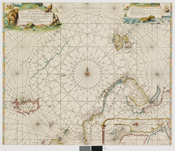
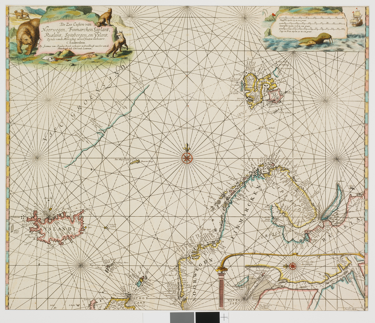
Kart som har vært en del av Varmingsamlingen. Varmingsamlingen inneholdt kart fra 1598 til 1827 og besto av omkring 1500 bøker, 60 kart og 250 svalbardsedler, alle med tilknytning til Svalbard og arktis.
Kart over Norge, Finnmark, Lapland, Russland, Island og Spitsbergen fra 1680. I nedre høyre hjørne innfelt kart over innseilingen til Archangelsk. Kartet ble publisert i atlaset De Groote Nieuwe Vermeerderde Zee-Atlas ofte Water-Werelt / J. van Keulen. - Amsterdam, 1680.


Add a comment or suggest edits
To publish a public comment on the object, select «Leave a comment». To send an inquiry directly to the museum, select «Send an inquiry».