Funn innkommet ved arkeologiske utgravninger i forbindelse med E39 Kanten-prosjektet, Lindesnes kommune, Agder fylke. Prosjektet har bakgrunn i anleggelse av ny tilførselsvei mellom Ime og Greipsland, Lindesnes kommune, i forbindelse med ny E39 mellom Kristiansand og Ålgård. Lokalitetene ble registrert av Vest-Agder fylkeskommune i 2017 (Fredriksen 2017), og registreringsfunn er katalogisert under C61718 (id 170377), C61720 (id 230292) og C61721 (id 230301). Utgravningene ble utført av Kulturhistorisk museum i perioden. 27.7.–23.10.2020. Fire lokaliteter med dateringer fra steinalder til moderne tid ble undersøkt i prosjektperioden. Samtlige lokaliteter befant seg i dyrket mark og ble undersøkt ved en kombinasjon av maskinell flateavdekking og manuell graving i mekaniske ruter og lag. Funn og prøver er katalogisert under følgende C-nummer: Kanten 1 (id 230301): C62651, C62652, C62653, C62654, C62655, C62656. Kanten 2 (id 230292): C62657, C62658. Ime Myran (id 170377): C62659, C62660, C62661. Jakobhola (id 170420): C62662.
Vedartsbestemmelser av 116 trekullprøver er utført av Karen V. Salvig ved Moesgaard museum; 104 radiologiske dateringer av er utført av 14C-laboratoriet i Lund og 46 av Tandemlaboratoriet ved Uppsala universitet; jordmikromorfologianalyser av ti prøver er utført ved Dr. Richard Macphail ved University College London mens osteologisk analyse av ti beinfragmenter, én pollen- og to diatoméanalyser, samt analyser av makrofossiler fra til sammen 31 prøver er utført ved Arkeologerna, Statens historiska museer. I tillegg er analyser av mulige harpiksfragmenter utført hos SciCult (Science for Cultural Heritage) ved Kulturhistorisk museum, Universitetet i Oslo.
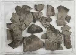
Funnomstendighet: Arkeologisk utgravning. Lokaliteten Ime Myran lå på ca. 6,5–18 moh., i kupert terreng, delvis i beitemark og delvis på en beplantet kolle. Lokaliteten ble undersøkt ved en kombinasjon av maskinell flateavdekking og manuell graving i mekaniske ruter (0,25 x 0,25 m eller 1 x 1 m) og lag (10 cm dybde). Ved graving i ruter og lag ble masser gjennomgått ved vannsålding i såld med 2–4 mm maskevidde. Totalt ble 2522 m2 flateavdekket, mens 41,2 m3 ble manuelt gjennomgått. Fra lokaliteten i sin helhet ble det samlet inn nærmere 8645 littiske funn. Det ble påvist fem aktivitetsflater hvor funnmaterialet viste opphold fra både mesolitikum, neolitikum, samt yngre innslag i form av keramikk og kokegroper fra bronsealder og jernalder. Funnmaterialet fra Ime har blitt magasinert under C-nr. 62659–65661. Aktivitetsområdene A, B og C på kollen fikk tildelt ett C-nummer (C62660) og aktivitetsområdene D og E nede på flaten ett (C62661). I tillegg ble det tildelt ett til lokaliteten som helhet for katalogisering av prøver, funn som ikke kan knyttes til aktivitetsområdene og funn fra strukturer (C62659).
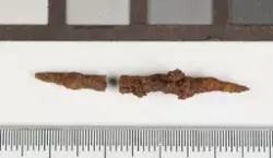
I alt ble det undersøkt 24 arkeologiske strukturer med dateringer fra senmesolitikum til eldre jernalder. I kombinasjon med dateringer gjort på brente hasselnøttskall fra de ulike steinalderområdene viser strukturene flere adskilte bruksfaser fra mellommesolitikum til eldre jernalder, med tre mer intensive bruksperioder i senmesolitikum, tidlig- til mellomneolitikum og eldre bronsealder.