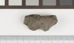
aboutVasket, tørket og veid. Vedartsbestemt av Helge I. Høeg. 40 biter ble bestemt, alle var av bjørk. Hele prøven ble forbrukt ved datering. Dateringen ga resultat til yngre romertid- tidlig folkevandringstid: 1765 ± 80 BP/kal. 70-430 e.Kr. (T-19881, DF-4198).
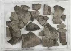
Området ble registrert av Aust-Agder fylkeskommune i 2006, og KHM gjennomførte utgravning på stedet sommeren 2007. Bakgrunnen for undersøkelsen var en utvidelse av eksisterende Rv9-trasé. Utgravningen ble gjennomført ved hjelp av maskinell flateavdekking i belter på omkring 15-20 m bredde på begge sider av eksisterende riksveitrasé, men stedvis med utvidelser opp mot ca 35 m bredde. Terrenget faller slakt via to markerte, lave terrasser fra nord mot sør, fra ca 217 moh. til 213 moh. Feltet er stort, og det var tydelige konsentrasjoner av funn/strukturer i deler av området. For best å kunne håndtere den store datamengden, er hele feltet blitt delt inn i seks delområder (1-6) fra nord til sør. Størst var konsentrasjonene i delområdene 2 og 5. Inndelinga av funn- og prøvematerialet i C-nummer følger inndelingen i delområder, men enkelte delområder med flere hustomter e.l. rommer flere C-nr. Utgravingsmaterialet er katalogisert under C.57175-57185 og C.57191, til sammen 12 C-nummer. C.57177 omfatter funn og prøvemateriale i Delområde 2 fra groper med ukjente funksjoner, kokegroper (deriblant et par usedvanlig store, rektangulære) og ca 20 esser med spor etter jernbearbeiding i form av bl.a. slagg og ovnsforing (brent leire). Slaggmengden varierte i de ulike essene, og essenes størrelser varierer også. Det er relativt mye jern i slagget, og slagget i de ulike essene er ensartet. Et representativt utvalg slagg er samlet inn og magasinert, men mindre biter som slaggperler, glødeskall o.l. er trolig noe underrepresentert i det magasinerte materialet. Innsamlet materiale domineres derfor først og fremst av større biter. Eksempelvis kan det nevnes at utgravd halvdel av esse S-1005 inneholdt ca 8,6 kg slagg/ovnsforing, mens S-1079 inneholdt 4,1 kg. Dette materialet er ikke magasinert. Det ble ikke gjort funn som gir klare hint om hva slags jernbearbeiding som har foregått (få gjenstandsfunn i sikker tilknytning til dette aktivitetsområdet), men det er ingen primær jernproduksjon, og det er heller ingen finsmiing. Funnstedet ligger ute langs kanten av en svakt markert NNØ-SSV-orientert brink i det ellers flate åkerlandskapet. De fleste av strukturene lå konsentrert til et ca 15x20 m stort område utenfor et stort, treskipet langhus (ca 49x9 m) i samme delområde. Funn og prøver fra selve huset (Hus II) er oppført under C.57176. C14-dateringer fra stolpehull og ildsteder i dette huset har gitt resultater til yngre romertid. Altså er det samtidighet mellom Hus II (C.57176) og kokegropene og essene (C.57177), og disse bør ses i sammenheng. Det ble også påvist sikre stolpehull inniblant essene og kokegropene. Det lot seg ikke skille ut eller avgrense noen sikker bygning her, men at stolpehulla er spor etter en bygning regnes som sikkert. Dette mulige huset, kalt Hus VIII, har trolig vært orientert om lag N-S, men konstruksjonsmessige detaljer, størrelse og alder er høyst usikre. I Delområde 3 sør for og nedenfor nevnte brink, men i en avstand av 50-100 m fra de her omtalte funnene ble det påvist et kokegropfelt med enkelte C14-dateringer til samme periode. For ytterligere fellesopplysninger om utgravningen, se C.57175.