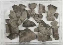
I forbindelse med legging av vannledning på strekningen Staver - Bryn ble det foretatt arkeologiske registreringer langs traseen. Funnene fra registreringen har fått Cnr 56542 til 56547. Lokaliteten ligger sørsørvest for tunet på 78 Vøyen og befinner seg i dyrka mark på en plan forhøyning i landskapet. I sørvest går det en bratt skråning med tett vegetasjon ned mot den meandrerende Isielva. Lokaliteten består av bosetning- og dyrkningsspor, nærmere bestemt 39 stolpehull, tre ardsporområder og ti nedgravninger og ett dyrkningslag. Det er en høyere konsentrasjon av strukturer nærmest tunet. Trolig er det en blanding av eldre og nyere aktivitet, da enkelte av strukturene som opptrer i moderne dreneringsgrøfter nødvendigvis må være av nyere dato. I tillegg fikk et stolpehull nyere tids datering. Det er en del forstyrrelser i området, i form av dreneringsgrøfter og anleggelse av høyspentmast. Lokaliteten er datert til yngre steinalder .På lokaliteten ble det kun funnet en bit av brent leire i et stolpehull.
Kullprøver fra 3 strukturer ble radiologisk datert. Dateringene strekker seg fra tidligneolittikum til nyere tid.