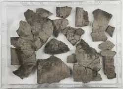
History
-
For fellesopplysninger: Se C55696
C55697
Prøver fra R29. Gropene ligger spredt ut over et område som måler 420 m N - S, og 50 m Ø - V. Terrenget består for det meste av barskog. Skogbunnen domineres av mose og lyng. Undergrunnen består av sand (brunjord). Det ble undersøkt 8 groper ved manuell snitting. Det ble tatt ut kullprøver fra bunnen av gropene. En grop er tolket som fangstgrop, de andre som groper med ukjent funksjon.Funnet: 2006
- FunnstedViken Ullensaker Bjørtomt R29
- FunnstedViken Ullensaker Elstad Østre R29
Periode
middelalder, nyere tid
References
-
- Kulturminnesøk89404
License information
- License Attrbution-ShareAlike (CC BY-SA)
Metadata
- IdentifierC55697.6
- Owner of collectionKulturhistorisk museum
- InstitutionKulturhistorisk museum, Universitetet i Oslo
- Date publishedOctober 26, 2022
- Date updatedOctober 26, 2022
- DIMU-CODE0210212047301
- UUIDd845a0c5-8bd0-4d30-8f0a-a269f3b3f0fa
- Tags