-
Photo: Svalbard museum
Kart
About the object
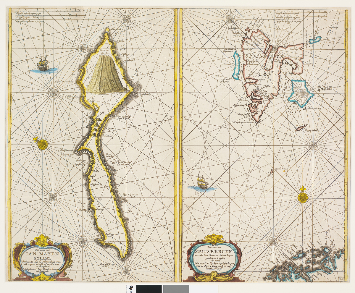
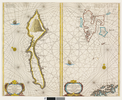
- aboutTo kart på ett blad sammensatt av to ark. Venstre side viser Jan Mayenog høyre side viser Spitsbergen. Baksiden er blank.
- DesignationKart
- Alternative nameAtlas (Ikke-kontrollert betegnelse (overskrift))
- Precise designationGrafisk trykk
- IdentifierSVB 10912
- Indexing termKulturhistorisk materiale / Cultural history
- Specific subject termsKart
- Type Thing
-
Inscription
- Primær, Påskrift: Pas-caert van IAN MAYEN EYLANT, Verthoonde alle de gelegentheyt van alle bayer, inbochen, diepten en en drooghten. t Amsterdam by Iacob Theunisz op´t water inte Lootsman.
- Primær, Påskrift: Pas-caert van SPITSBERGEN met alle haer Rivieren, havens, bayen, sanden en droogten. als mede Hoe men C. de Uytkyck op Spits-bergen van de Noord Caap en BeerenEy: landtbezeyensal.
- Primær, Påskrift (håndskrevet med blyant): Wieder nr 129 s 77 1666
-
Dimensions value
- Bredde56.0 cm
- Høyde45.0 cm
- MaterialsPapir
- Decoration techniquesGrafisk trykk Kobberstikk
-
Other information Kart som har vært del av Varmingsamlingen. Varmingsamlingen inneholdt kart fra 1598 til 1827 om besto av omkring 1500 bøker, 60 kart og 250 svalbardsedler, alle med tilknytning til Svalbard og arktis.


Send an inquiry
Your message will be sent to Svalbard museum.
Add a comment or suggest edits
To publish a public comment on the object, select «Leave a comment». To send an inquiry directly to the museum, select «Send an inquiry».